
Walk a Lockport Street by Address
A sound street-by-street search starts with place, not a person's name. Will County keeps separate assessment, mapping, and recorded-instrument systems. None alone proves who lives behind a door. The first task is to fix the current parcel, then preserve enough fields to find the same land when the street label or parcel number changes. Work from the least sensitive public source and keep the date of each result.
- Enter the number, street name, and optional city in the Supervisor of Assessments Address Search. Save the displayed PIN and address form.
- Compare that place in the Will County GIS Data Viewer. Check the parcel shape, street layer, municipality, and layer date.
- Use the PIN, address, and names in the Recorder's search routes. Read the instrument before treating an index hit as ownership evidence.
- Use the county voter form only for a lawful registration check with the required identity facts. Its visible controls do not offer an open street-name browse.
- For an older household, ask White Oak Library whether the relevant edition has a street or telephone cross-reference. Cite the edition and page.
The flow is address to parcel, parcel to deed, and only then to a limited household clue. That order prevents a mailing label, map polygon, or deed signer from being mistaken for a current occupant. It also makes the Lockport street directory useful when spellings vary.
Lockport Street Search Fields
The county's 9-1-1-based address form accepts a street number, street name, and optional city. Number-only and street-only inputs use contains behavior, which helps when the exact form is not known. A result should still be checked with the township assessor because county data is compiled from local assessment records. If the address itself appears wrong, the official page points to Will County 9-1-1 Addressing for assignment and verification.
| Form field | Input | Search behavior | Best use |
|---|---|---|---|
| Street Address Number | Number | Contains if used alone | Narrow one part of a Lockport street |
| Street Name | Name without guessing a person | Contains if used alone | Browse matching county address forms |
| City/Town | Optional place label | Further filter | Separate similar street names |
| PIN Search | Full or partial dashed PIN | Starts with | Follow related or prior parcels |
The official address-search form shows the controls before any personal result is opened.
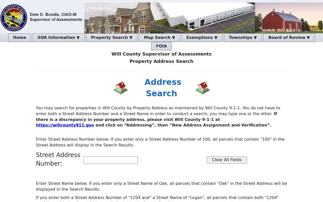
This view confirms which inputs are actually available and avoids claiming that the assessor offers an unsupported household field.
Reading Lockport Parcel Language
A parcel is a mapped unit of land with a parcel identification number, or PIN. A situs address is the physical site label, which may differ from an owner's mailing address. A plat is a recorded map that lays out lots, blocks, streets, or subdivisions. A criss-cross directory, when an edition includes one, reverses the usual name index and groups entries by address or street.
- PIN
- A 14- or 16-digit property code tied to a legal description and tax record. Lockport township uses code 11.
- Situs address
- The location assigned to the parcel, not proof of a person's residence.
- Plat
- A recorded land map that can explain street dedication, lot lines, or a parcel split.
- Criss-cross directory
- An edition arranged by place rather than only by surname. White Oak staff can confirm whether a volume contains one.
The county PIN search accepts partial forms, a useful insider method when a split has changed the final digits. Compare its PIN with the Recorder's PIN_RECORDER form before following deeds.
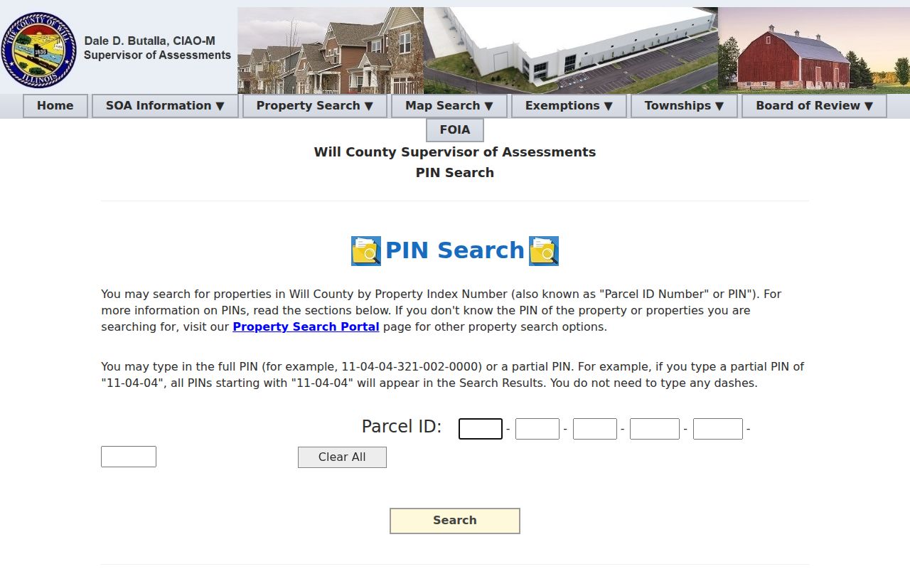
The PIN form is a bridge between a street result and a recorded land description, not a resident roster.
Lockport Records Indexed by Street
Address-keyed sources overlap but do not say the same thing. The Lockport street directory becomes more reliable when every claim is limited to the source's role. The assessment system describes a tax parcel. GIS describes location and geometry. The Recorder indexes instruments. Municipal files may document a permit, plan, plat, or inspection. Election tools verify registration under strict terms; they are not a public browse of everyone along a road.
| Address source | Official keeper | What it can establish | Access path |
|---|---|---|---|
| Assessment parcel | Will County Supervisor of Assessments | PIN, site address, assessment context | Free address and PIN forms; township confirmation |
| Parcel and street layers | Will County GIS Division | Geometry, street parts, city and ZIP attributes | Viewer, metadata, and public REST layer |
| Deeds, plats, and releases | Will County Recorder | Parties, document number, date, and legal description | Free Direct Search, paid systems, archive, copies |
| Permits and plans | City of Lockport or Will County Land Use | Address-linked project or application records | Portal when available, counter, email, or FOIA |
| Historical directories | White Oak Library and regional repositories | Edition-specific names, phones, or address clues | Library shelves, staff help, and limited digital collections |
Do not merge those rows into one confident household statement. Preserve the document date, layer date, and exact record type. If a deed and GIS entry disagree, the deed controls its legal description while GIS controls its mapped geometry.
Map Lockport Streets in GIS
Will County GIS lists more than 70 layers, including address points, parcels, streets, buildings, municipalities, railroads, trails, zoning, political districts, and taxing districts. They are updated on different schedules. The research capture showed weekly updates for streets and address points, while other layers had separate dates. A street search must therefore record the date and the layer used.
The public parcel service exposes fields such as house number, direction, street name, suffix, city, ZIP code, PIN, PIN_RECORDER, property class, valuation date, and acreage. It can also return geometry and spatial relationships. The layer did not expose an owner name in the captured sample, so it must not be described as a title database.
The county vector-data catalog lists address, street, parcel, and boundary layers available for comparison.
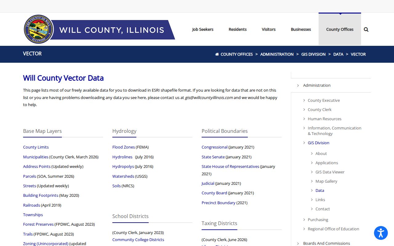
The catalog separates each geographic layer and its update context, which helps prevent a boundary line from being read as a household fact.
The official parcel-layer schema makes those limits visible.
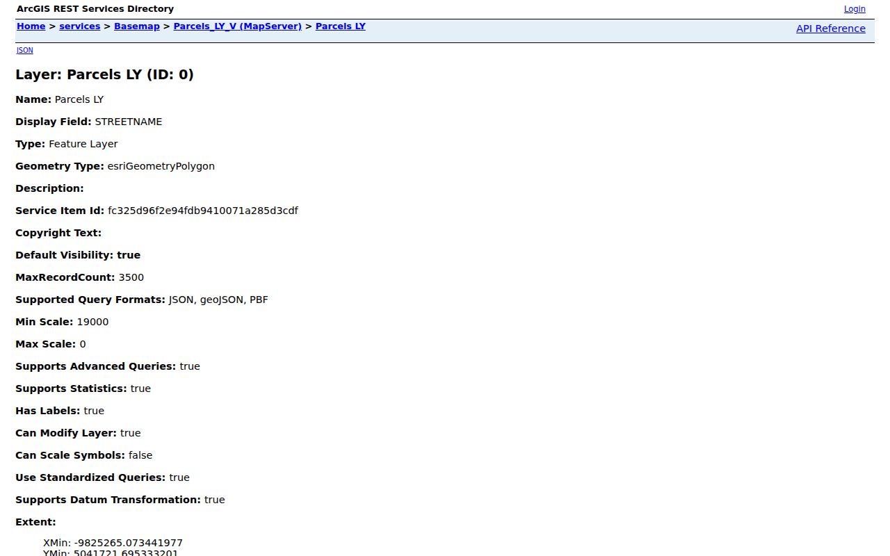
The schema view helps explain why a map can locate land without naming the people who occupy it.
Note: Save the layer date with each Lockport street result because geometry and assessment dates may not move together.
Lockport Address Layers Differ
A Lockport mailing label, parcel CITY value, municipal boundary, 9-1-1 address, and historical directory entry are not interchangeable. That is the key local myth to avoid. The parcel query for records whose CITY field equals LOCKPORT returned ZIP values 60435, 60441, and 60491. This does not prove that every such parcel is inside Lockport city limits or that each ZIP is a complete Lockport postal area.
Compare the street against official city maps, the county municipality layer, and USPS address validation. The Lockport maps page supplies ward, subdivision, and zoning context.
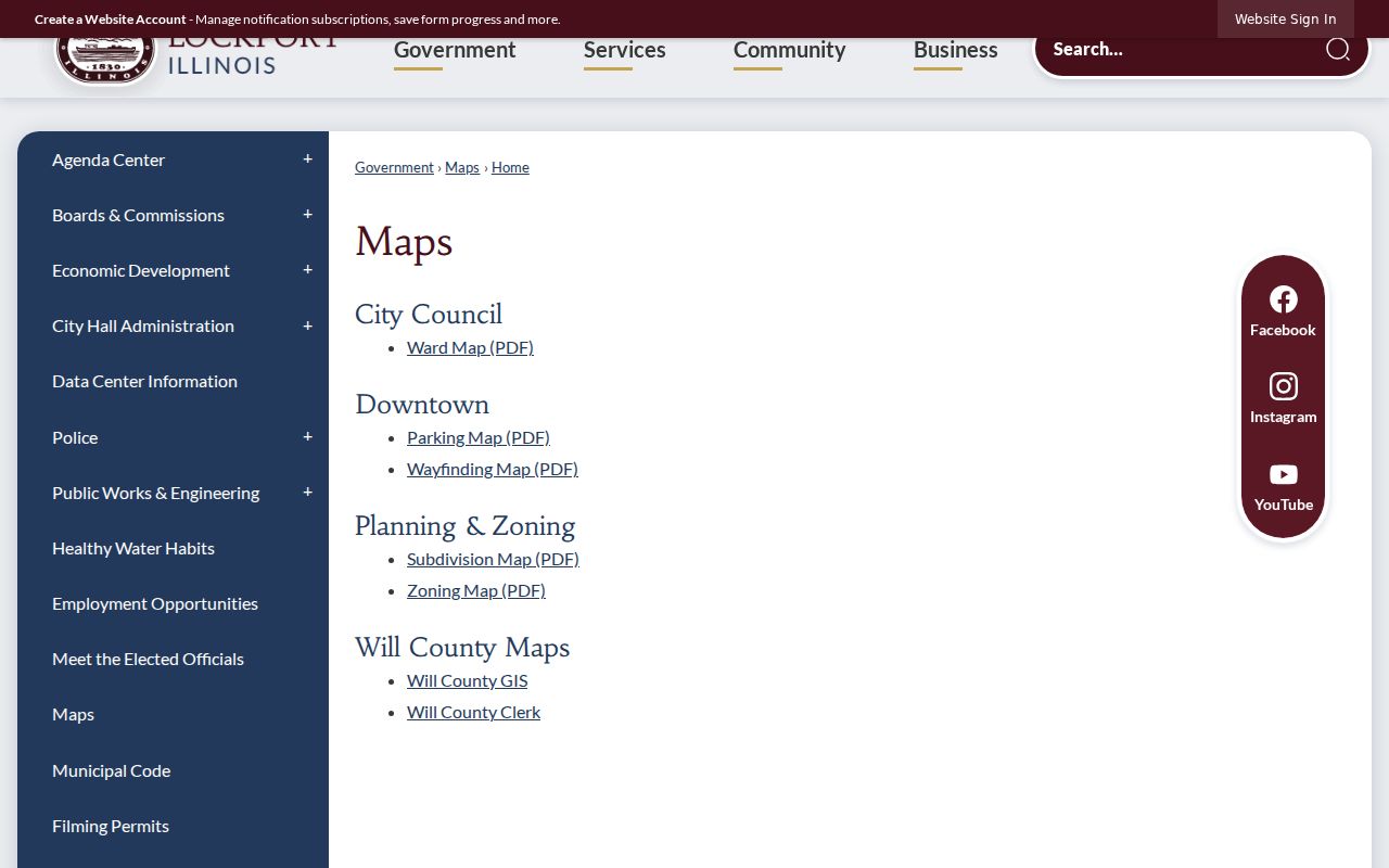
Those maps show civic geography that a postal label or assessor city field cannot settle by itself.
Follow Lockport Deeds by Street
The Will County Recorder holds land instruments from the county's 1836 inception. Online images are generally available from 1965 forward, while older work moves to the public archive, microfilm, historic indexes, books, plat books, and maps. Direct Search is free. Laredo is subscription access, and Tapestry is pay as you go. An exact document number is the cleanest copy request.
Address search is a convenience index. Confirm each hit in the instrument, then save grantor, grantee, document number, recording date, type, PIN, book and page, and legal description. Grantor means the party conveying an interest; grantee means the party receiving it. Search both roles separately because a name may appear as a trustee, signer, or entity representative rather than an occupant.
The street directory works best when the PIN and legal description carry the chain through a changed address. Search a shorter Lockport PIN prefix if a parcel division may have changed the final digits. Keep both the old and current address forms in the research notes.
Lockport Permits Need Fallbacks
A permit lead may exist in city or county files, but the access channel depends on the project. Will County Land Use describes searches by permit number, site address, owner, applicant, contractor, or undashed PIN. The City Clerk's record index includes permits, applications, inspection reports, plats, surveys, plans, covenants, certificates of occupancy, and city real-estate records.
The City Building page was routing applications in person or by email while online permitting was under maintenance. That means a failed portal is not the end of a Lockport by-address search. Ask the Building Department which office holds the file, then submit a narrow Illinois FOIA request to the City Clerk when needed. State the address, record class, and date range rather than asking for every record on a street.
The Lockport Building Department is the controlled source for the current route.
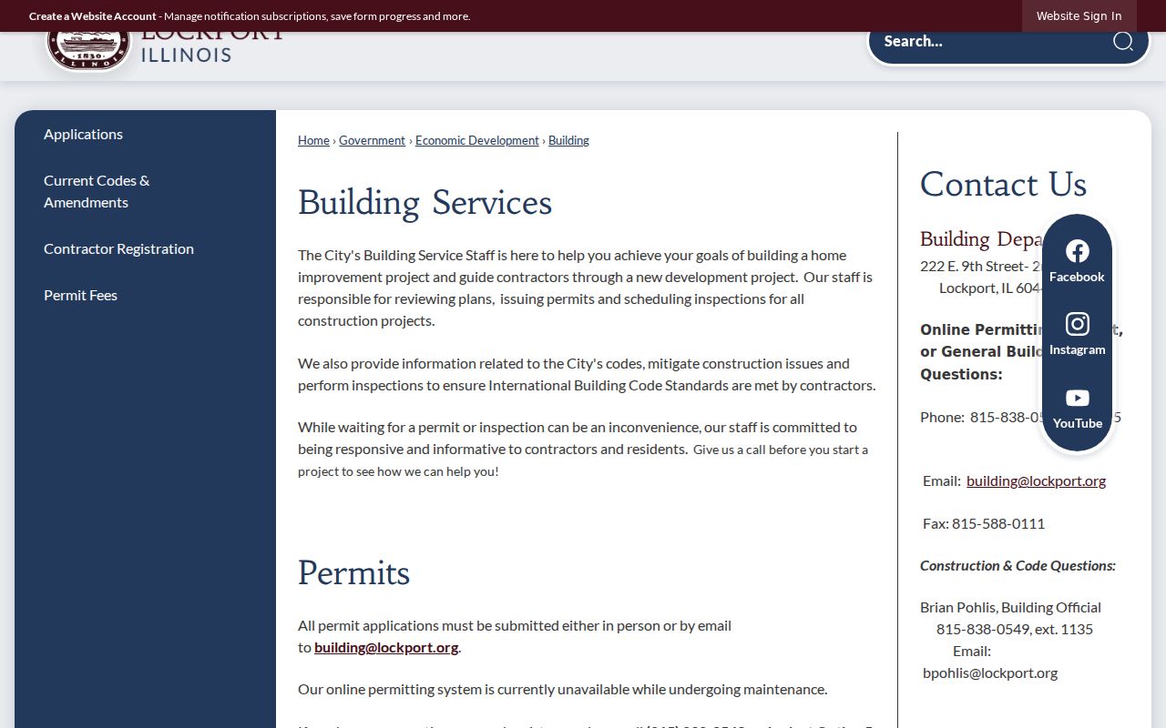
This screen documents the fallback path without claiming that a complete live permit index was captured.
Note: A permit may name an owner or applicant, but it does not prove who lived at the site.
Older Lockport Streets Need Maps
Historical address work needs sources built for their own era. White Oak Library holds Lockport city directories dated 1859/1860, 1872/1873, and 1899/1900, telephone runs from 1924 through 1952 with gaps, later Lockport volumes, and Polk Joliet-area editions through 2020. Not every edition is known to have a reverse street section. Ask staff before assuming one does.
University of Illinois Sanborn holdings list Lockport sheets for 1886, 1891, 1897, 1902, 1909, and 1926. These maps can show block and house numbers, structure use, building material, and water details. A Sanborn block number is not a modern PIN. Use the map to test street alignment, then return to a plat, deed, or directory citation.
The historic collection itself belongs on the Lockport city directories page. For street work, record only the edition, page, address form, and the narrow evidence needed to connect the old label to the parcel.
Limits of Lockport Street Records
No official Lockport street directory lists every current person at every address. A parcel can be vacant, multi-unit, held by a trust, or mailed to an address elsewhere. A deed records an interest in land, not day-to-day occupancy. A directory can omit people, use a stale listing, name only a subscriber or head of household, or show a business location.
The Will County voter form requires first name, last name, date of birth, and house number. It does not expose a visible open street-name field in the captured form. Illinois voter data also carries redactions and strict bans on intimidation, advertising, solicitation, and broad personal use. Do not guess a birth date or republish a street number.
Lawful use. Use Lockport address records for careful personal, family, property, or civic research. Never use them to track, stalk, harass, threaten, or harm anyone.
If safety is involved, Illinois offers an Address Confidentiality Program for eligible survivors, and the Recorder has a document-specific redaction request. Neither route is a general name deletion tool. Respect withheld fields and ask the source custodian about correction or protection.